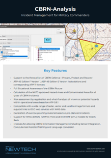
Key features in CBRN-Analysis

Reinforcing support
Support to the three pillars of CBRN Defence: Prevent, Protect & Recover

NATO approved
Calculation of the NATO approved Hazard Areas and Contaminated Areas for all types of CBRN Incidents

Wide GIS compatibility
Compatible with a wide range of raster, vector and satellite image formats. Support links to OGC web services with WMS data.

Built-in briefing generation
Briefing reports can be automatically generated to provide incident and risk object information for briefing commanders or other stakeholders. Information includes any hazards detected, map-based predicted hazard areas, and any checklists and procedures that apply.

Situational awareness
CBRN-Analysis is designed to provide commanders with rapid and accurate information to help increase their situational awareness of the battlefield and enable informed decision-making to save lives, protect assets, and maintain efficient operations.

Operational management
The software automatically calculates the predicted CBRN hazard area and can quickly display that information on a map to the operator. The same data is used to identify key interest areas and units that are at risk.

Software updates
CBRN-Analysis is continuously updated to comply with the latest editions of ATP-45 and AEP-45, currently ATP-45(F)(2) and AEP-45(E)(1). There are no additional costs or mid-life upgrades required as the NATO standards evolve. Continued compliance is secured as part of the CBRN-Analysis subscription.

NATO compliance
CBRN-Analysis complies with the latest NATO standards and an annual software release ensures compliance maintenance. The relevant standards include the NATO publications of STANAG 2103 ATP-45 and STANAG 2497 AEP-45. Maintenance of these standards in the software offers the customer the opportunity to maintain interoperability with NATO Commands and partner nations.

‘What-if’ objects for pre-emptive planning
CBRN-Analysis provides the ability to set up defined ‘risk objects’ within the software. The ‘risk object’ can be a facility, a venue or location where there may be a risk of a CBRN release. All known data about a ‘Risk Object’ can be stored in CBRN-Analysis to create a knowledge base for planning and if required, reactions to a subsequent incident. The ‘risk object’ and any associated hazard area are shown on the map in CBRN-Analysis.
CBRN-Analysis is an advanced, off-the-shelf CBRN Defence Knowledge Management Software Application that provides Knowledge Management, Hazard Prediction, and Warning and Reporting (W&R) capability, supporting the planning and execution of operations.
Providing commanders with rapid and accurate knowledge to increase their CBRN situational awareness within an area where a risk of CBRN hazards may exist.
CBRN-Analysis effectively supports and enhances risk-management in all phases of an operation, through the planning and pre-deployment phase, in-theatre execution, and in the post-conflict or recovery phase. CBRN-Analysis complies with the latest NATO standards. These include the NATO publications of STANAG 2103 ATP-45(F)(2) and STANAG 2497 AEP-45(E)(1). CBRN-Analysis is the global market leader in the digital application of CBRN knowledge management software that meets the latest warning and reporting standards. The software also supports intelligence preparation of the operational environment (IPOE) which allows users to place known potential hazards within their operational areas, enabling critical infrastructure protection.
Modules to extend the functionality & utility of
CBRN-Analysis and CBRNE-Frontline

GIS
Supports Open Geospatial Consortium (OGC) web services with Web Map Service (WMS) data. WMS is a supported format for maps and Geographic Information System (GIS) data, accessed via secure nets like NATO Core GIS or via the web, loaded into client-side software e.g. CBRN-Analysis or CBRNE-Frontline.

Language support
All products are available in English as default but can be modified to another specified language. With the Local Language Support module, all products are provided in the local language selected by the customer.

COP
The Publish CBRN COP (Common Operational Picture) module enables the operator to export hazard warning areas from CBRN-Analysis and CBRNE-Frontline to other Knowledge Management systems.

CAX
The CBRN-Analysis CAX (Computer Assisted Exercise) Player is an automated training module that can be used to maintain the currency of trained operators in the operation of CBRN-Analysis, using Bruhn NewTech supplied pre-defined exercises.

NFFI
The NFFI/FFI (NATO Friendly Force Information) module enables automatic update of units in CBRN-Analysis and CBRNE-Frontline from the Battle Management, C2, C4 or other Mission Management systems.

Dispersion models
A number of atmospheric dispersion models (e.g. Rimpuff) can be used with CBRN-Analysis and CBRNE-Frontline for more detailed hazard area predictions.
Let’s have a talk
We’re always happy and available to meet for a conversation about our many products. We’ll do our best to give relevant and valuable insights on how our solutions might be able to help and support you in protecting and saving lives.